
Our only agenda is to publish the truth so you can be an informed participant in democracy.
We need your help.


• Google told PolitiFact that it has not made any "blurring changes" to its satellite images of Russia.
• Some of the Russian facilities that social media users claim are now suddenly visible have been available in high resolution on Google platforms for years.
Pigeons, airplanes, satellites and drones have long been used to produce aerial photos that guide military action on the ground. But in recent years, these images have moved beyond military circles. They are sometimes also being shared on social media to push false information and influence public perception of wars.
Before Russia invaded Ukraine in February, satellite images were used to track the massing of Russian troops around Ukraine. Then they were used to reveal the movement of Russian tanks towards Kyiv, to expose the destruction caused by the war across Ukraine, and to document the atrocities committed by Russian forces in Bucha.
Some satellite images have been shared with false information. That was the case with a Facebook post published on April 18 that claimed that Google Maps started publishing images of secret Russian facilities in unprecedented high resolutions.
"Google Maps has opened all military and strategic facilities in Russia," including "naval bases, launch pads, and command posts," the post said. "This symbolic act allows anyone to ‘wander’ through secret places in Russia."
The post includes four satellite images that supposedly show Russian military facilities and assets in unprecedented detail. PolitiFact confirmed that one of the images shows a Russian aircraft carrier, and The Verge confirmed that a second image is of a Russian military facility, but it’s unclear if the other images in fact show Russian military sites and assets.
The post was flagged as part of Facebook’s efforts to combat false news and misinformation on its News Feed. (Read more about our partnership with Facebook.)
At the request of governments, Google presents blurred images of military facilities in some countries, including Belgium, France, and Germany, to hide sensitive information. And the company can sometimes start providing sharp images of areas that were previously presented as blurred, once restrictions are lifted.
But Google told PolitiFact that it has not recently made any "blurring changes" to its satellite images of Russia. PolitiFact asked Google if those images had always been available with that level of detail, but did not get a response to that question.
Some of the images of Russian facilities that social media users say are now suddenly visible have been available for years in high resolution on services like Google Maps and Google Earth.
One Reddit post claimed that because of the alleged change in blurring settings, it was suddenly possible to see the Russian military base of Lipetsk in greater detail. But a Russian military news website shared high-quality images of the same base in 2015 and 2021, crediting Google Earth.
A Facebook post claimed that following Russia’s invasion of Ukraine, Google Maps started publishing high-quality satellite images of Russian military facilities.
Google told PolitiFact that it has not made any changes to its satellite images of Russia. High-quality images of some of those Russian assets have been available online for years on Google services.
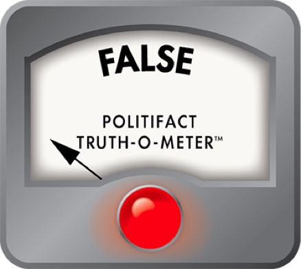
We rate the post False.
The New Yorker, "The turn-of-the-century pigeons that photographed Earth from above," April 14, 2018
BBC, "How access to satellite images shifts the view of war," March 22, 2022
The New Republic, "Are these satellite images war propaganda?" March 31, 2022
The Washington Post, "Russian military movements near Ukraine: What satellite images show," Dec. 8, 2021
The New York Times, "New satellite images show more Russian forces massing on three sides of Ukraine," Feb. 10, 2022
Reuters, "Russian convoy of ground forces, tanks moving toward Kyiv, Maxar says," Feb. 27, 2022
The New York Times, "A new satellite image shows food lines in Mariupol, as Russian forces push deeper into the city," March 30, 2022
The New York Times, "Satellite images show bodies lay in Bucha for weeks, despite Russian claims," April 4, 2022
BuzzFeed News, "How open-source intelligence is helping clear the fog of war in Ukraine," March 2, 2022
The Moscow Times, "Google denies removing blurring for Russia’s military sites," April 19, 2022
The Verge, "Google denies Ukrainian reports it unblurred satellite Maps imagery in Russia," April 18, 2022
BBC, "Google to be sued by Belgium for not blurring military sites," Sept. 28, 2018
TopWar, "Russian military facilities on fresh Google Earth images," Nov. 3, 2015
TopWar, "American target aircraft and air defense breakers based on decommissioned fighters," Nov. 18, 2021
Email exchange with Google’s press office. April 19, 2022
In a world of wild talk and fake news, help us stand up for the facts.